Since 1992
Print and digital marketing
PHOTO: The Height of Land scenic overlook. (RLHT photo)
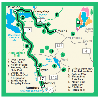
RANGELEY — The corridor management plan for the Rangeley Lakes National Scenic Byway is being updated, and public input is being sought by the Rangeley Lakes Heritage Trust and Scenic Byway Council.
The byway comprises 52 miles on routes 4 and 17, highlighting the scenic, natural, cultural, historic, archaeological and recreational values of the route, which stretches from Rumford, through the Rangeley region, to Madrid. RLHT was a participant in the original Citizens’ Advisory Group that was created to guide the development of the corridor management plan, and has been the coordinator and fiscal agent for the byway since national designation in 2000.
Since that time millions of dollars have been invested in enhancements to the byway and the Rangeley community, including new public restrooms in Rangeley and Oquossoc villages, new scenic overlooks at Height of Land and Whip Willow Farm, more than 40 interpretive signs, and more.
RLHT is working with the Scenic Byway Council to rewrite the plan, which will include a vision for the byway and plans further enhancements and marketing over the next five years. The National Scenic Byways program was created in 1991, but has not been funded since 2012. A bill pending in the U.S. Senate Appropriations Committee includes $35 million for scenic byways and represents the first dedicated funding for the program in nearly a decade.
To join the Scenic Byway Council, contact Nancy Perlson, at nperlson@rlht.org.