
Since 1992
Print and digital marketing
In the midst of rapidly changing directives surrounding the cononavirus response, more people are taking walks around the roads less traveled — or even the roads well traveled. Avoiding frost heaves and the occasional pothole, there are bound to be views one doesn’t see or note while driving or biking. Here are a couple from a recent stroll.
Readers — Do you know where this is?
[Answer is at the bottom].
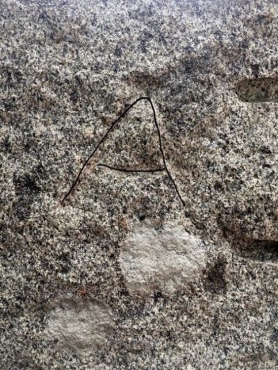
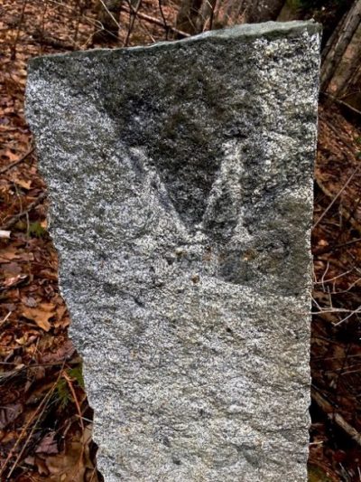
These boundary markers stand as companions to moss-covered rock walls, and it’s unlikely anyone would notice them unless on foot. The M stands for Minot; the A for Auburn, and although modern signs mark these locations for motorists, these pieces of granite tell a story of another time, more than a century ago. The Auburn marker, which has an M on the back, is difficult to see but easier to feel. The Minot marker, which has an A on the back, is in better condition.
The markers are on Bailey Road, which connects Wilson Hill Road (formerly Sturkes Road) in Auburn to a section of Holbrook Road, which runs along the western shore of The Basin. It originates in Auburn at the foot of the steep hill on North Auburn Road and crosses into Minot shortly before intersecting with Bailey Road.
“The Town of Auburn was created in 1842 out of a piece of Minot,” said Doug Hodgkin, local historian, former president and currently secretary of the Androscoggin Historical Society, indicating the markers may date back that far. “The town selectmen were supposed to perambulate (survey) the town boundaries every few years to make certain that the boundary markers were still in place. It would be possible that the one in better condition was a replacement.”
If you know of town markers where you live, walk or drive, we’d love to hear from you and see what you see on the Maine road less traveled.
Send your photos and information to articles@turnerpublishing.net.
(Linda Galway photos)


